Towards the end of the very humid wet season, we visited Darwin in Australia’s tropical Northern Territory to sample the diversity of ground-layer plants across a string of experimental fire plots. The long-running experiment at the Territory Wildlife Park prescribes different fire regimes, varying in the frequency and timing of burns, to demonstrate ecosystem impacts while controlling for other factors. Our fieldwork here forms part of a broader effort by the Global Grassy Group to build a pan-tropical dataset from similar fire experiments - so far also in Zambia, South Africa and Brazil - creating a unique opportunity to compare how fire shapes tropical ecosystems across continents.
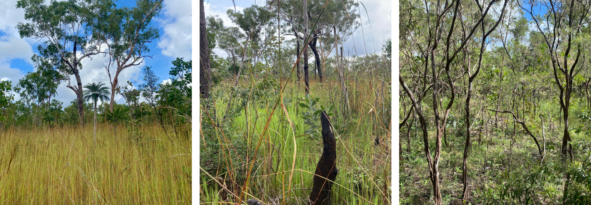
Figure 1. Experimental burn plots at the Territory Wildlife Park with varying fire regimes, from left to right: early season burn every year, early season burn every five years, and without burns for at least 36 years.
The gradient across the burn plots is remarkably clear, ranging from closed-canopy forest where fire is excluded through to open savanna under more frequent and intense fire regimes (Figure 1). There was so much in bloom - especially in the savanna plots - that recording and collecting specimens usually involved grappling with towering, spiky sorghum grasses to reach the smaller species hidden beneath (Figure 2).
Australia’s tropical savannas are among the most extensive and intact savanna ecosystems on Earth. While the scattered Eucalyptus trees define their appearance, most biodiversity in savannas is concentrated in the ground layer. Understanding how fire influences the diversity of grasses, sedges and forbs is critical, particularly as changing climate and fire regimes continue to alter tropical ecosystems globally.
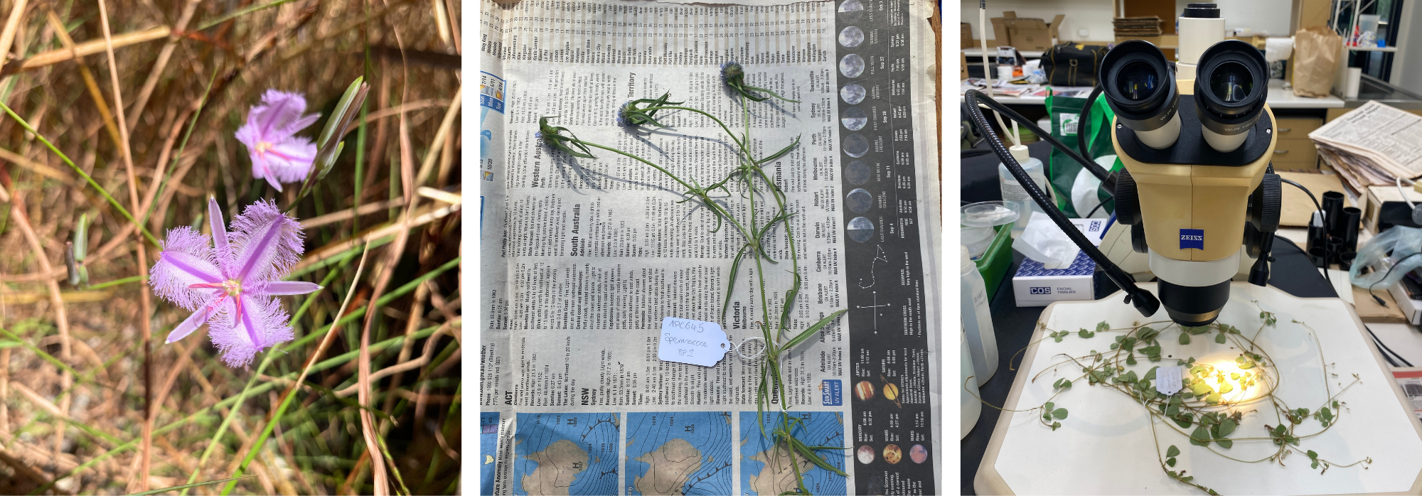
Figure 2. The process of collecting and identifying ground-layer plants, from left to right: observing in the field, pressing specimens, and identifying using reference collections.
In addition, we were permitted to work in several protected areas, including Litchfield National Park with its magnificent termite mounds, waterfalls and Banksia dentata (Figure 3), to focus on something a little different from our usual surveys. Interested in identifying structural metrics that can distinguish forests from savannas on the ground, we applied the Global Grassy Group protocol to record variables including grass height, litter depth and tree cover. We also ventured into the unfamiliar territory of tree identification (and thankfully not crocodiles).
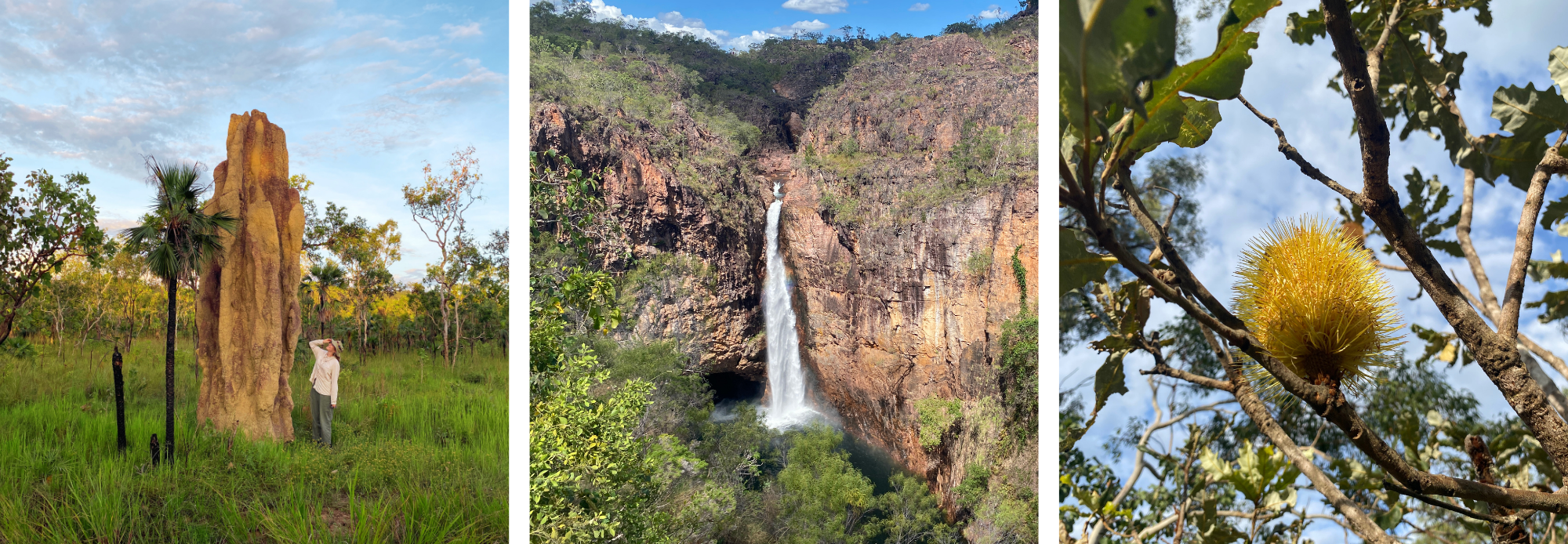
Figure 3. Features of the savanna in Litchfield National Park.
A key component of this work was collaboration with Australia’s Terrestrial Ecosystem Research Network (TERN), whose Ecosystem Surveillance program has spent more than a decade monitoring vegetation across the country using standardised methodologies. The TERN plot network represents one of the world’s most comprehensive vegetation monitoring datasets, providing a nationally consistent framework for measuring plant diversity and ecosystem change through time. By sharing approaches and expertise, we ensured that our Global Grassy Group and TERN datasets could be meaningfully compared, highlighting the importance of strong local partnerships, regional expertise and long-term monitoring networks in enabling international research. Together, these plot networks and our collaborators provide the infrastructure, field experience, and botanical and ecological knowledge needed to connect widely distributed experiments and datasets through common methods, placing local observations into a global context (Figure 4).
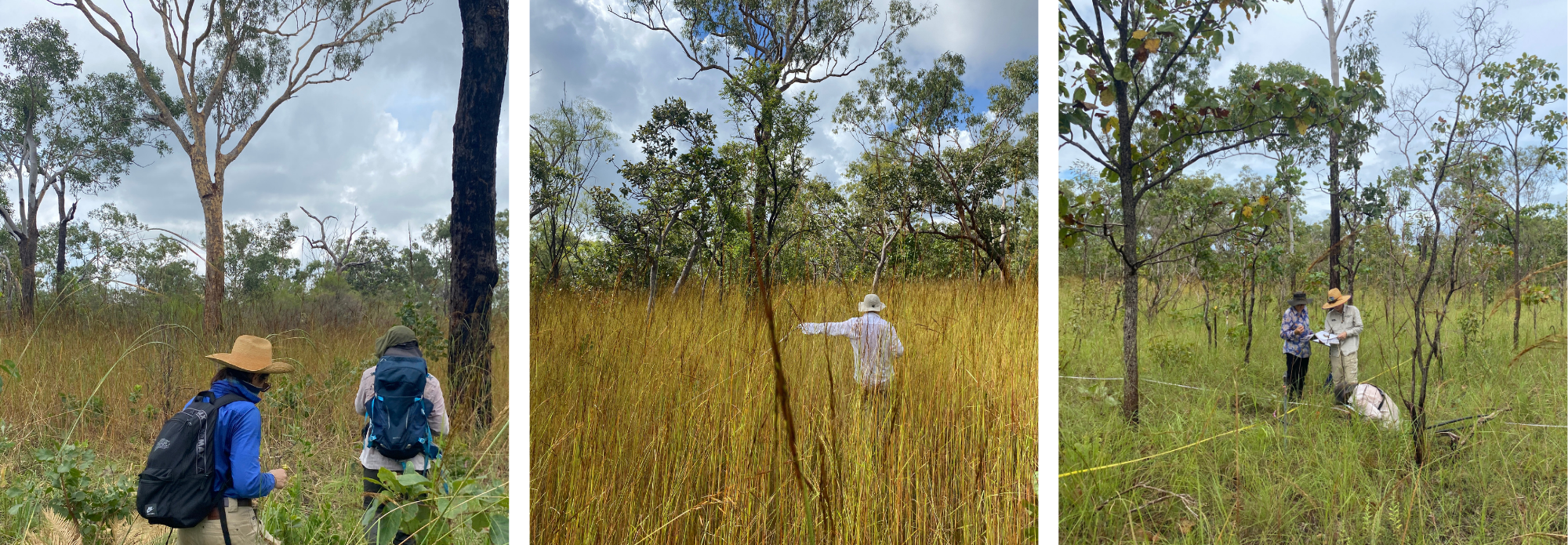
Figure 4. Collecting data and sharing knowledge in the field.
We are incredibly grateful to our collaborators at TERN, CSIRO, La Trobe University, the Northern Territory Herbarium, Charles Darwin University and the Territory Wildlife Park for their generous support, expertise and hospitality, which made this fieldwork possible.